• Current weather conditions and the forecast
A tornado watch had been posted for the entire Washington metro area until 2 a.m. Saturday, although it was discontinued early for some counties. Forecasters had also issued a tornado warning for eastern parts of the District on Friday afternoon.
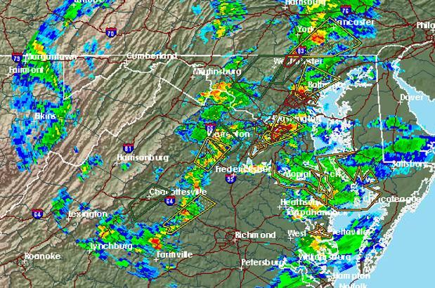
Scattered storms began to move northeast across Northern Virginia and Maryland on Friday afternoon. The National Weather Service warned that some storms could be severe and capable of producing damaging winds, large hail and isolated tornadoes.
After a first round of storms reached western portions of the region in the afternoon, another bout of severe weather arrived later in the evening.
“The primary threat from this round of severe weather will be damaging wind gusts and isolated tornadoes,” according to a statement from the weather service.
A tornado warning was posted until 5:15 p.m. for eastern parts of the District and western Prince George’s County. Weather service radar at 4:42 p.m. indicated a severe storm capable of producing a tornado near Fort Washington.
A tornado warning was issued for parts of Loudoun and Montgomery counties earlier Friday after radar indicated a severe storm capable of producing a tornado near Brambleton. Forecasters said strong rotation was observed with the storm.
Skies were expected to be clear this weekend, with highs in the upper 70s.