California drivers traveling through national parks need to monitor their GPS directions before they find themselves in a muddy situation.
The National Park Service alerted California residents to several road closures in the Mojave National Preserve due to flash flooding that some mapping services may still mark as open.
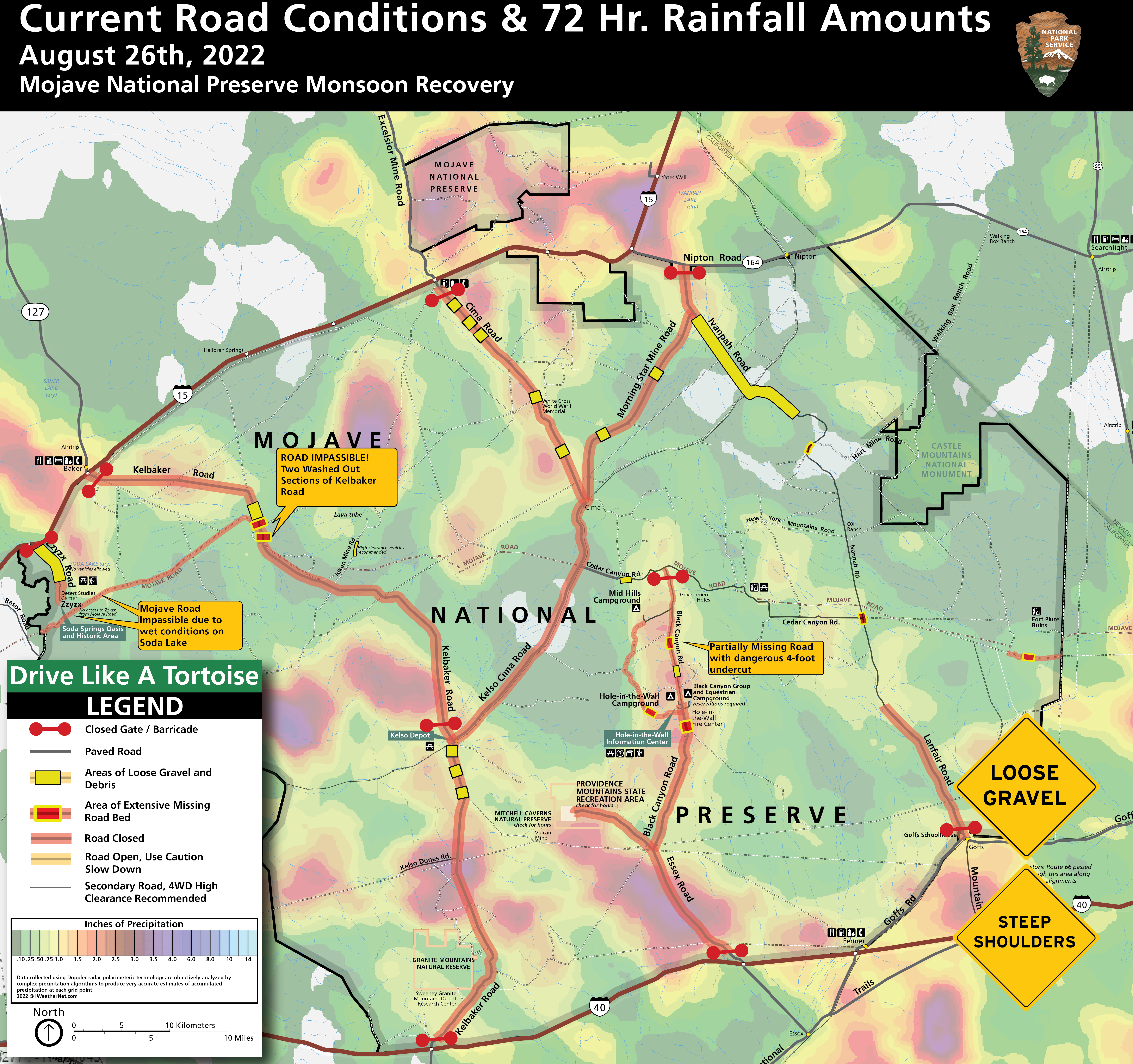
“Drivers seeking short cuts or bypasses on secondary paved roads will likely encounter closures or hazardous road conditions including rocks and gravel, pavement undercutting, steep shoulder drop-offs, and flooded washes,” the department said in a statement released on Wednesday. “Many roads are not suitable for passenger vehicles in these conditions.”
MARINE CORPS VETERAN FOUND DEAD IN DEATH VALLEY AFTER RUNNING OUT OF GAS
The Mojave National Preserve, established in 1994 as part of the California Desert Protection Act, is unique from other national parks, as several travelers will cross through the preserve to avoid Interstate-15 or 40, which park officials say is not practical as the preserve cannot handle the heavy traffic volumes coming from the interstate.
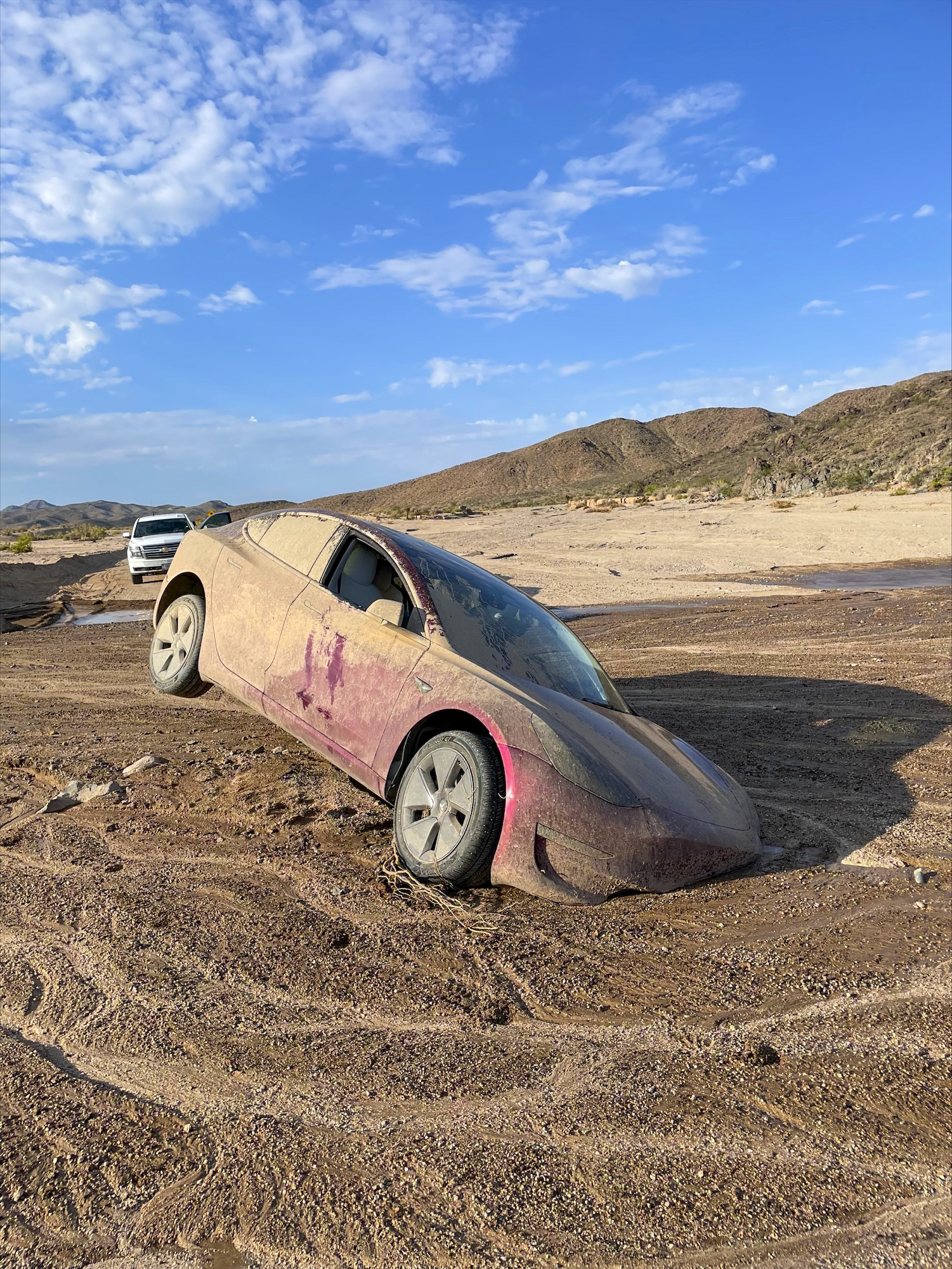
The preserve encompasses 3 of 4 major North American deserts: Mojave, the Great Basin, and Sonoran. Eight roads within the preserve are closed due to flooding from Aug. 26, including the Mojave Road, a pathway through the desert that is impassable due to standing water and deep mud that “would strand even four-wheel drive vehicles.”
The hazardous road conditions are the effects of monsoon storms in the area that cause flash flooding. The area typically sees rainfall of approximately 3.5 inches to 10 inches, most of which occurs between November and April. However, summer months will often see sudden, heavy rainfall, which causes damage to several roads throughout the preserve.
CLICK HERE TO READ MORE FROM THE WASHINGTON EXAMINER
The Washington Examiner reached out to the National Park Service for data on vehicles stuck in the mud over the past year and recent summer months.