

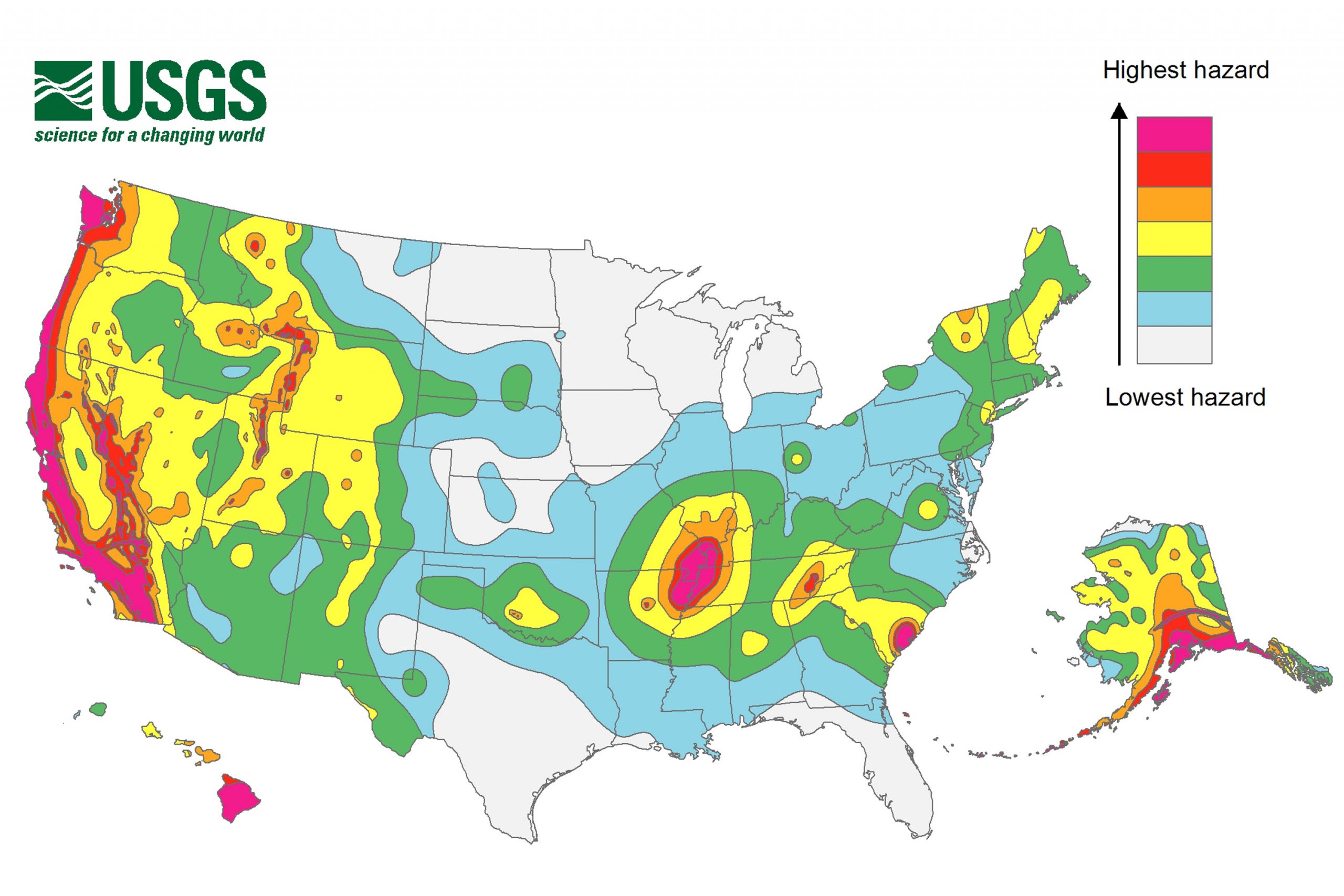
WASHINGTON (AP) — A new federal earthquake map dials up the shaking hazard just a bit for about one-third of the United States and lowers it for one-tenth.
The U.S. Geological Survey on Thursday updated its national seismic hazard maps for the first time since 2008, taking into account research from the devastating 2011 earthquake and tsunami off the Japanese coast and the surprise 2011 Virginia temblor.
Stay informed.Stay ahead.
Join Washington Examiner for unlimited access to the news, analysis, and commentary that matter most.
See Options
Already a member? Log in
Print subscriber? Click here to login/register your account
Digital subscriber? Click here to login/register your account.
