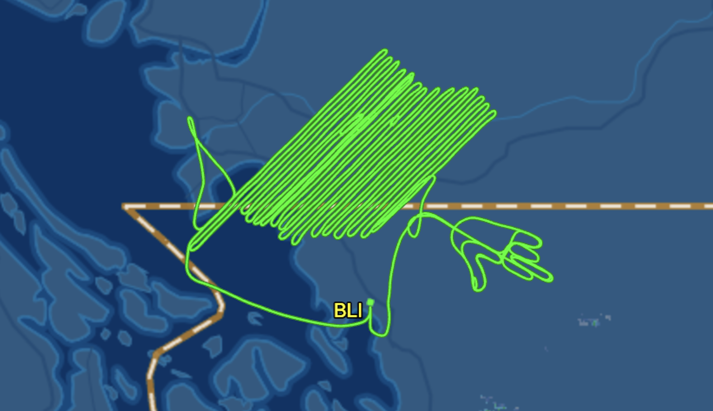
A pilot took to the skies of Washington state and used the plane’s flight path to give Whatcom County “the bird.”
Flight tracking data from FlightAware showed the unidentified pilot’s path, which traced the image of a hand with its middle finger extended above the county’s skies Monday.
The unique flight path was first touted on Reddit with the caption, “Looks like a Survey Pilot’s last day today.”
WATCH: DESANTIS CALLS FOR IRS AUDITS ON LAWMAKERS WHO VOTED FOR INFLATION REDUCTION ACT
The post quickly garnered several hundred comments.
“Talk about detail, he even put a thumbnail on!” one Reddit user said.
Another joked: “Must be a pro at Etch A Sketch.”
According to FlightAware, the plane took off at 9:15 a.m. from Bellingham International Airport and was gone for about seven hours as it traced the “flipping off” outline at approximately 11,000 feet and made several tight zig-zags across northern Whatcom County and British Columbia airspace east of Vancouver. The plane landed back at Bellingham International Airport just after 4:00 p.m.
CLICK HERE TO READ MORE FROM THE WASHINGTON EXAMINER
The flight information did not list the pilot’s identity but identified the plane as a Piper Navajo twin-piston that is registered to MARC, Inc. in Bolton, Mississippi.
MARC provides “specialized contract aircraft and flight crews for airborne GIS (airborne geophysical surveys), surveys and surveillance projects,” according to the company’s website.