Tropical Storm Arthur is moving toward the North Carolina coast, bringing with it some dangerous weather conditions.
Heavy rain, strong winds, and life-threatening surf and rip currents are possible within the tropical storm warning area along much of the North Carolina shoreline on Monday.
Recommended Stories


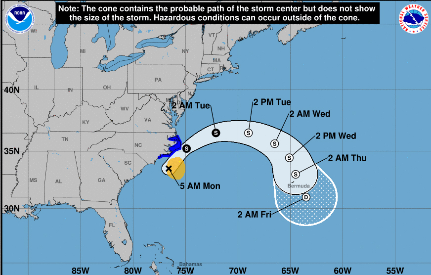
The center of Arthur, which became the first named storm of the 2020 Atlantic hurricane season over the weekend, was less than 100 miles south-southwest of Morehead City by 5 a.m., according to the National Hurricane Center.
A landfall is “very possible” over the Outer Banks in the morning on Monday, said AccuWeather meteorologist Alyson Hoegg.
Tropical Storm #Arthur 5am Monday, May 18 Key Messages: Tropical Storm conditions are expected along portions of the North Carolina coast later this morning. Latest advisory at https://t.co/tW4KeFW0gB and local info at https://t.co/SiZo8ohZMN pic.twitter.com/FGNs0t3KiY
— National Hurricane Center (@NHC_Atlantic) May 18, 2020
Although some strengthening is expected over the next 48 hours, the storm is not expected to become a hurricane, which would require sustained maximum winds of at least 74 mph, according to the Saffir-Simpson Hurricane Wind Scale.
By Tuesday, the storm is expected to curl out into the ocean.
Hurricane season does not officially start until June 1, but it is not unheard of in recent years for a tropical system to form early.