The National Hurricane Center downgraded Hurricane Ian to tropical storm status early Thursday morning after the storm began to weaken gradually overnight Wednesday as it moved across central Florida.
Ian was moving northeast across Florida at about 8 mph with maximum sustained winds of 65 mph at 5 a.m. Thursday, according to the NHC. However, the agency warned that Ian could pick back up and reach hurricane strength as it reaches Florida’s east coast on Saturday, posing risks to Georgia and the Carolinas.
“The amount of water that has been rising and will likely continue to rise today, even as the storm is passing, is basically a 500-year flood event,” Gov. Ron DeSantis said on Thursday. “We’re going to see a lot of images about the destruction that was done in southwest Florida, and, obviously, we have massive assets there, but people should just understand this storm is having broad impacts across the state.”
More than 2.5 million people were without power as of Thursday morning, with some areas along Florida’s Gulf Coast completely dark. Some cities, such as Orlando and others in central Florida, were issued flash flood warnings early Thursday morning, with the NHC warning of “life-threatening” conditions.
HURRICANE IAN TRACKER: LANDFALL MAKE IN CAYO COATA AS STORM SMASHES FLORIDA
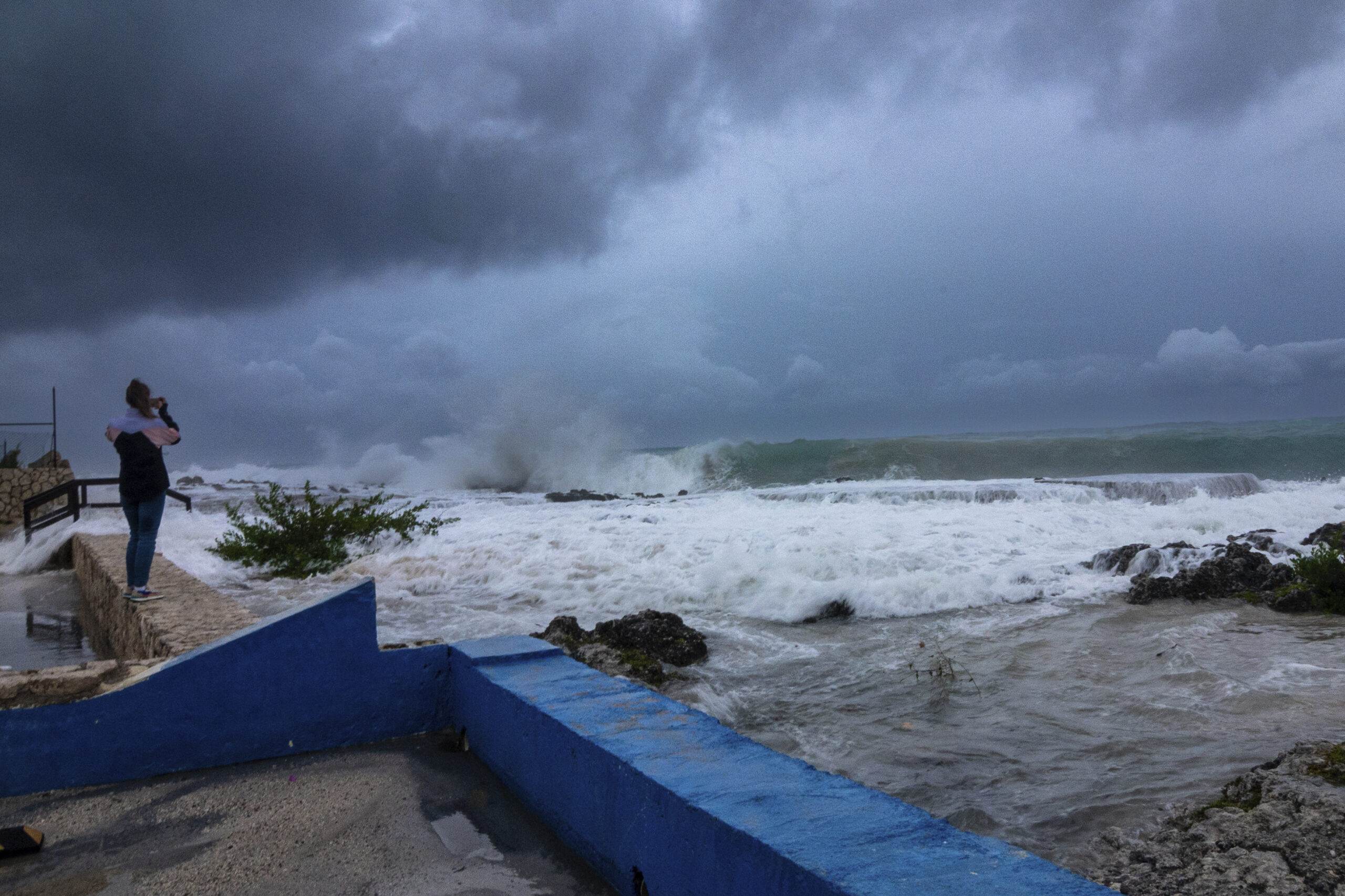
Ian has left a trail of devastation, knocking down trees and power lines throughout the lower half of the state, with some cities reporting water levels that were 3 to 4 feet high.
More than 1,200 flights that were scheduled for Thursday have been canceled, including hundreds that were to fly in and out of Orlando and Tampa, according to FlightAware. Additionally, Jacksonville International Airport canceled all flights going in and out of its terminal for Thursday.
Hurricane Ian made landfall in Florida just after 3 p.m. Eastern time on Wednesday as a Category 4 storm with maximum sustained winds of 150 mph, making it the strongest hurricane to rock the state since Hurricane Michael in 2018. State officials issued evacuation orders earlier this week before the storm reached the state, warning of possibly life-threatening conditions from high winds and heavy rainfall.
CLICK HERE TO READ MORE FROM THE WASHINGTON EXAMINER
However, not all residents heeded those evacuation orders, with state officials urging those who did not leave to remain inside. A portion of the Sanibel Causeway, the only bridge on and off the island of Sanibel, collapsed into the Gulf of Mexico after Ian tore through the area, leaving anyone on the island without an evacuation plan for now.
Some parts of the state have already recorded 12-19 inches of rain by Wednesday evening, with the NHC warning of “catastrophic flooding” through the end of the week.