A bipartisan group of Western lawmakers want to find a better way to help communities protect themselves from landslides.
The National Landslide Preparedness Act aims to fill in the gaps in scientific knowledge about which areas of the country face potential landslides by increasing the amount of data available on areas at risk for landslides and help communities build infrastructure to protect themselves.
Recommended Stories


The bill, sponsored by Sens. Lisa Murkowski, R-Alaska, Maria Cantwell, D-Wash., Patty Murray, D-Wash., and Dianne Feinstein, D-Calif., in the Senate and Rep. Suzan DelBene, D-Wash., in the House, would require the Interior Department to come up with a National Landslide Reduction Program with a strategy that would work across federal agencies.
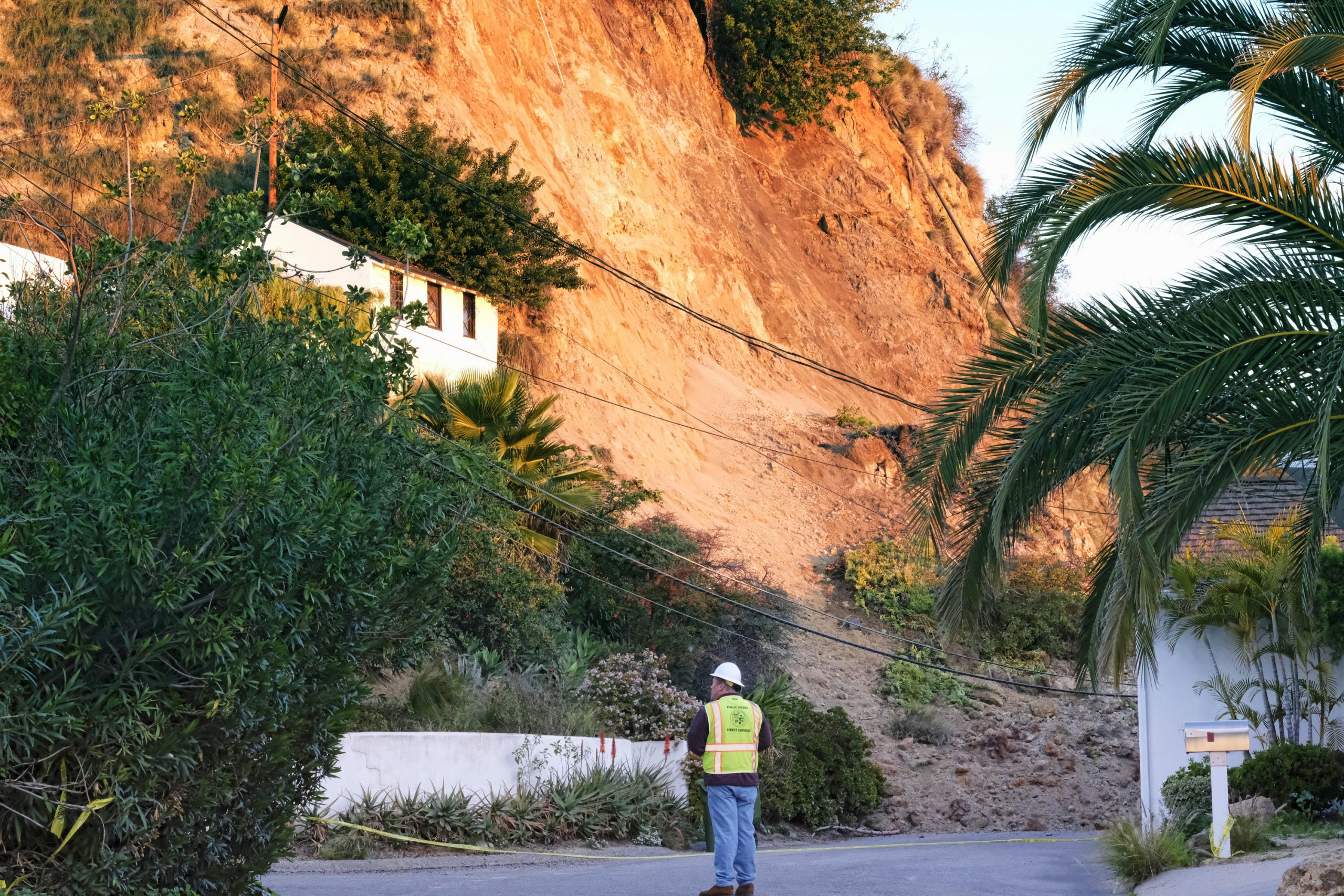
Landslides kill about 25 people and cost between $1 billion and $2 billion each year, according to the U.S. Geological Survey.
Recent storms in California and the ensuing landslides wreaked havoc on the state’s roads and bridges, Feinstein said.
“The recent storms in California left us with dangerous landslides that threatened lives, destroyed homes and damaged our roads and infrastructure,” she said. “Our bill creates a better system for mapping, assessing and improving emergency responses to landslides, mudslides and flash floods. Early detection of these traumatic events will make our communities safer and ultimately save lives.”
The U.S. Geological Survey runs a Landslides Hazard Program that monitors potential landslide risks and does research to make landslide hazard maps. However, the lawmakers contend that the agency is using outdated technology and systems to create its maps. The bill would require the creation of a 3-D elevation program, which uses high-resolution elevation data to create better topographical maps showing elevation and natural features.
Only about a quarter of the country has that kind of data collected, with the rest using information that is 30 years old and was collected with older technology, according to the lawmakers. The bill would allow communities to plan for and protect against natural disasters, Murkowski said.
“I’m hopeful that this bill will help reduce landslide hazard risks and will speed up the collection of [Interferometric synthetic aperture radar] data for the states to better prepare and protect our communities moving forward,” she said.
Interferometric synthetic aperture radar, or IfSAR, is the data collected by satellites or aircraft doing three-dimensional surveying. It has the ability to show changes in the composition of the Earth’s surface, including areas that may be eroding into a landslide risk.
The bill allows the Interior Department to award grants to fund increased collection of 3-D elevation data across the country.
The issue is personal to the lawmakers from Washington, where a 2014 landslide in Oso killed 43 people and destroyed 42 homes.
The landslide happened in an area that Geological Survey officials knew was a landslide risk, but it was much bigger and moved much faster than scientists could have predicted. The landslide moved at an average speed of 40 mph and covered an area a half-square-mile wide.
According to the Geologic Survey, 18 million tons of sand, till and clay covered the area — enough to cover 600 football fields in 10 feet of suffocating material.
The landslide even dammed off the North Fork Stillaguamish River at a depth of 25 feet, forming a 2.5-mile-long temporary lake. The lake flooded homes and other buildings. It took almost two months for the river to return to its normal flow.
DelBene said the disaster taught legislators a lesson.
“Lawmakers need to do more to ensure we fund resources and research efforts to prevent future natural disasters from becoming national tragedies,” she said.
“Every state in the country faces some amount of landslide risk. Substantial work needs to be done to gain better knowledge of landslides and their potential impacts in order to reduce losses of life and property. It is time that landslide hazards are addressed properly and in a collaborative fashion.”
A representative for the Geological Survey declined to comment on the legislation, pointing to its role as a science agency, but said its work helps predict landslides.
“USGS does not comment on pending legislation,” said Catherine Puckett, deputy public affairs officer, in an email. “However, USGS hazard research from earthquakes to floods to fires and landslides is instrumental in helping save lives and property.”
The bill would require the departments of Homeland Security, Commerce, Defense and Transportation to work with the Interior Department to create landslide preparedness planning for communities.
Among those proposals are national landslide research grants. Handed out by the National Science Foundation, the grants would give money to state, local and tribal governments; universities and colleges; and nongovernmental entities to study landslides and how to reduce fatalities and property damage when they occur.
The program could mean between $1.2 billion and $13 billion in annual benefits to the country, according to a study done by the lawmakers and the Geological Survey.
“This bill will help communities prepare and respond to landslides and other natural hazards, which is critical to protecting lives and keeping communities and infrastructure safe,” Cantwell said.