

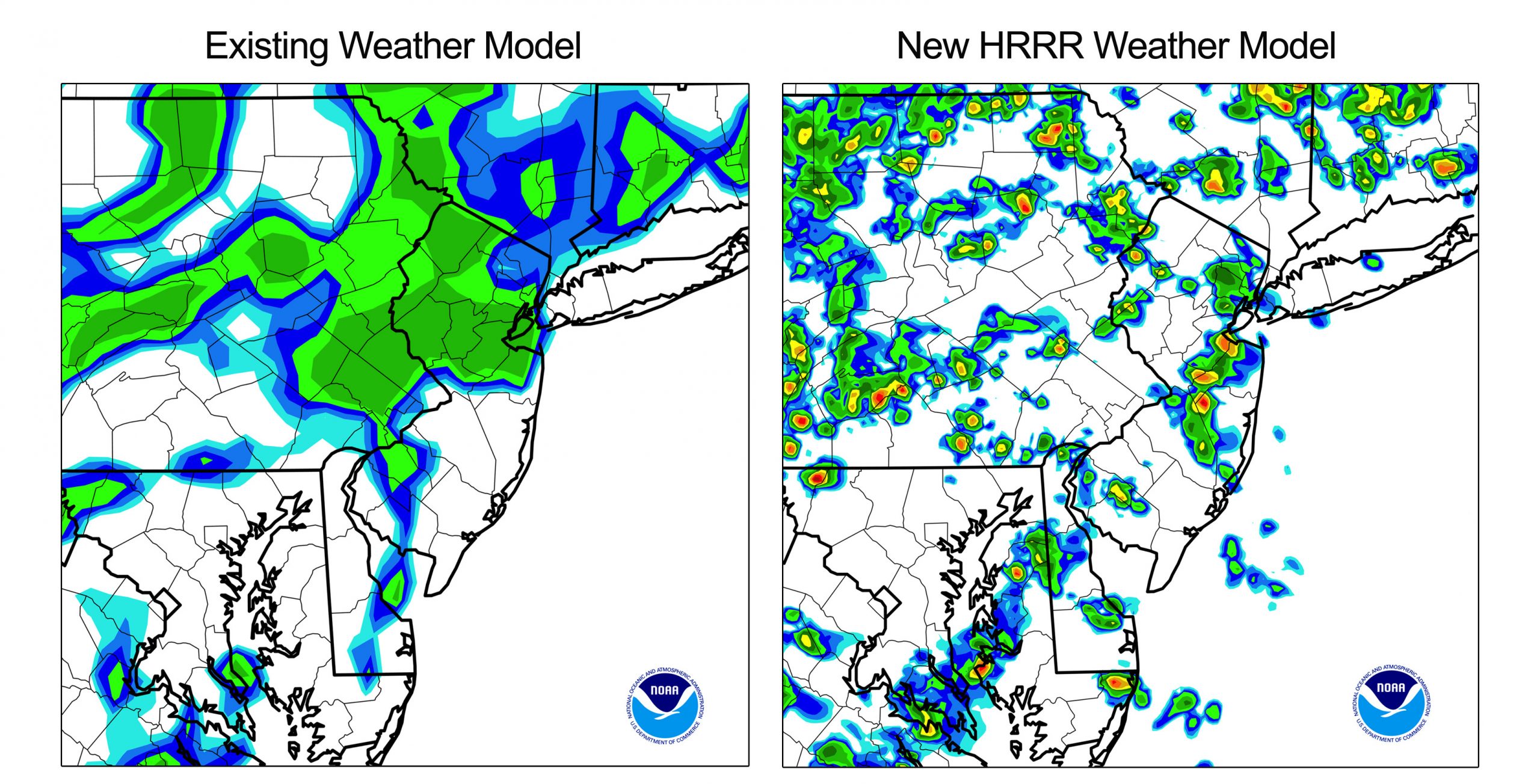
WASHINGTON (AP) — The next time some nasty storms are heading your way, the National Weather Service says it will have a better forecast of just how close they could come to you.
The weather service on Tuesday started using a new high resolution computer model that officials say will dramatically improve forecasts for storms up to 15 hours in advance. It should better pinpoint where and when tornadoes, thunderstorms and blizzards are expected, so people could take cover.
Stay informed.Stay ahead.
Join Washington Examiner for unlimited access to the news, analysis, and commentary that matter most.
See Options
Already a member? Log in
Already a print subscriber? Click here to login/register your account
