Hurricane Ian made landfall in South Carolina around 2:05 p.m. Friday as a Category 1 hurricane, bringing a watered-down version of the havoc it wreaked in Florida to the Palmetto State.
Recommended Stories


The storm is expected to unleash powerful winds with speeds of up to 30 mph to 50 mph as well as torrential downpours in parts of South Carolina. From there, the storm is expected to pull north. Gov. Henry McMaster (R) has already declared a state of emergency for South Carolina in anticipation of the storm.
HURRICANE IAN: MONSTER STORM MAKES LANDFALL AS CATEGORY 4 STORM WITH WINDS NEAR 150 MPH
“This is not as bad as it could’ve been … but we are not out of the woods yet,” McMaster declared in a briefing Friday.
Update: Surface observations indicate that the center of #Hurricane #Ian made landfall on Sep 30 at 205 pm EDT (1805 UTC) near Georgetown, South Carolina with maximum sustained winds of 85 mph (140 km/h) and an
estimated minimum central pressure of 977 mb (28.85 inches). pic.twitter.com/TNk43VBHUG— National Hurricane Center (@NHC_Atlantic) September 30, 2022
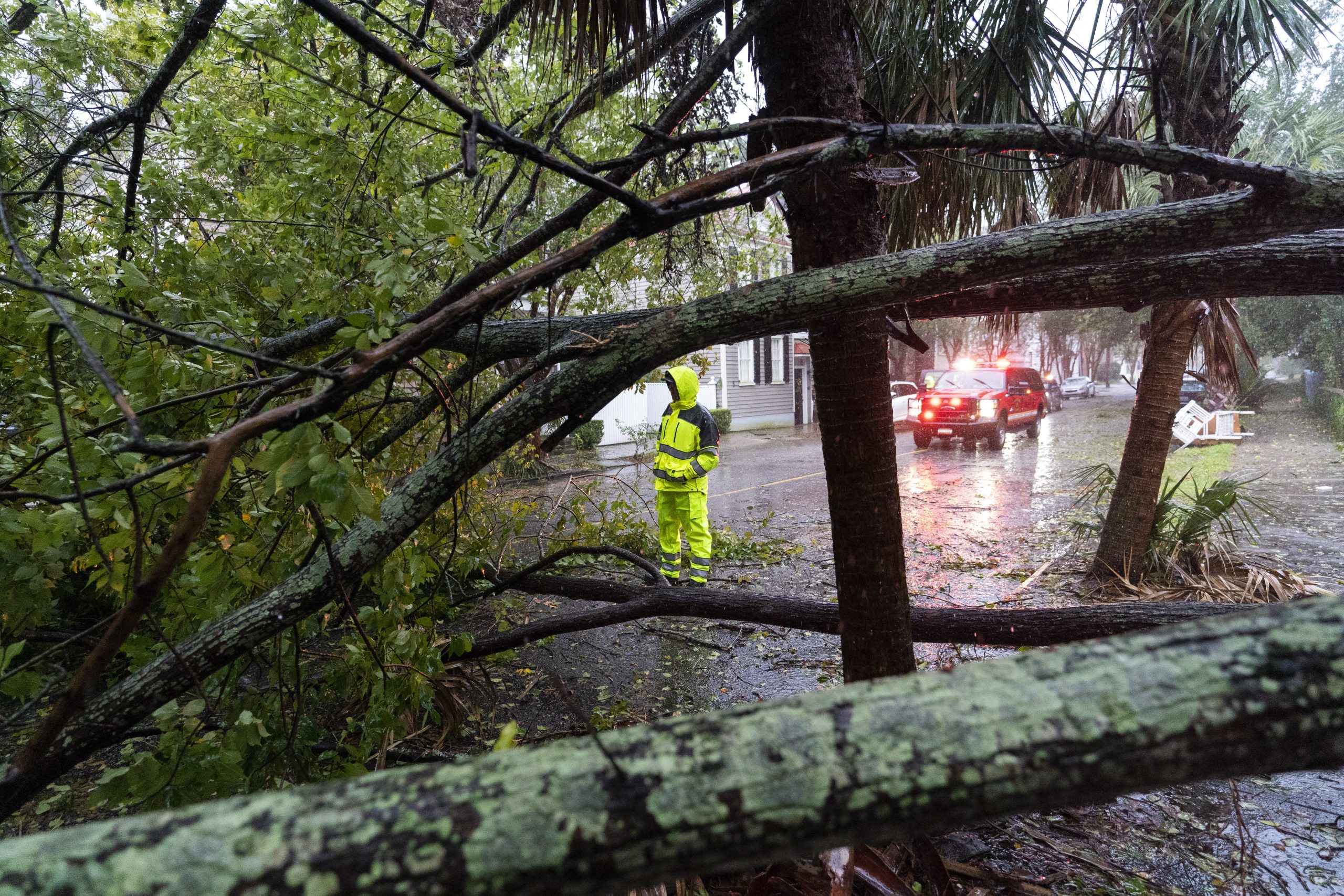
Even before Ian made landfall, intense wind gusts and flooding roared through Charleston, South Carolina, giving residents a preview of what is to come. As with Florida, Ian is expected to hammer South Carolina with widespread power outages and flooding.
Over 180,000 South Carolinians were already without power as of Friday afternoon, ahead of landfall, according to PowerOutage.us.
#Ian‘s next landfall is imminent. @TWCAlexWallace is LIVE in Myrtle Beach, South Carolina: pic.twitter.com/LvN9SaS25k
— The Weather Channel (@weatherchannel) September 30, 2022
Flooding in Cherry Grove, Myrtle Beach. Hurricane Ian landfall is imminent along the SC coast this afternoon. https://t.co/wz9kxVl3J3 pic.twitter.com/AViCo595AZ
— The Sun News (@TheSunNews) September 30, 2022
The National Weather Service issued a hurricane warning for all of South Carolina’s coastal region and portions of North Carolina, warning about an imminent “life-threatening storm surge.”
Ian previously touched down in Florida on Wednesday and is responsible for at least 21 deaths, though officials fear the actual death toll count is considerably higher. Roughly 2 million people were estimated to be without power as of Friday morning. Ian roared through the Sunshine State as a Category 4 storm before briefly turning into a tropical storm, then regaining power.
A #GOESEast perspective of Hurricane Ian weakening as it crossed the Florida Peninsula and restrengthening once it moved offshore over the Atlantic (and over the Gulf Stream). Ian is currently somewhat of a hybrid storm with both tropical and non-tropical characteristics. pic.twitter.com/i2lElLJPlL
— NWS Eastern Region (@NWSEastern) September 30, 2022
Meteorologists predicted Ian could raze Charleston County, which touts a coastline of roughly 100 miles, with waves eclipsing 9 feet in some areas, NPR reported. Much of the area was already under flash flooding warnings as locals braced for impact.
CLICK HERE TO READ MORE FROM THE WASHINGTON EXAMINER
President Joe Biden approved an emergency declaration for South Carolina, paving the way to dispatch federal aid to the state. The Federal Emergency Management Agency is authorized to assist in all 46 counties in the state.
In addition to hurricane concerns, parts of the state are also bracing for possible tornadoes, according to the NWS Eastern Region.
A Tornado Watch has been issued for parts of northeastern South Carolina, eastern North Carolina and southeastern Virginia until 10 PM EDT. This includes Wilmington and Greenville NC and the Norfolk-Virginia Beach area. pic.twitter.com/kAYjt0lyH5
— NWS Eastern Region (@NWSEastern) September 30, 2022